On-Line Scientific Buoy Network
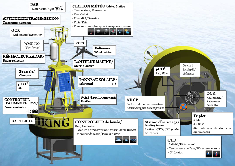
Fisheries and Oceans Canada monitors the marine environment using automated oceanographic buoys as one of its tools, designed and developed by a scientific team from the Maurice Lamontagne Institute, in partnership with Multi-Électronique. In addition to measuring a multitude of meteorological and oceanographic parameters at the water surface, these buoys independently collect temperature and salinity profiles to a depth of 200 m without human intervention, and transmit the data in real time.
The buoys are part of the Department’s Atlantic Zone Monitoring Program’s sampling strategy, which, since 1998, has been assessing the oceanographic conditions in the Gulf of St. Lawrence, the Scotian Shelf, and the Newfoundland and Labrador Shelf. The program aims to better understand, describe and predict the state of the marine ecosystem, as well as to quantify the changes observed in the physical, chemical and biological properties of the ocean, whether they be seasonal, yearly, or over longer periods. In fact, the buoys are floating laboratories that operate 24 hours a day. They are invaluable to the scientific community for studying climate change and monitoring the state of the ocean.
The automatically acquired profiles are used to quantify the rapid temperature and salinity changes that can occur (due to tides, for example) and to put into context the biological samples obtained by scientists on board vessels at much lower frequency. Mariners also appreciate having offshore wind and wave conditions available in real time from online services.
Characteristics of the On-Line Scientific Buoy Network stations
| Station | Buoy ID | Nominal Position (lat, long) | Station Depth (m) |
|---|---|---|---|
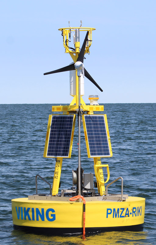
| Rimouski | PMZA-RIKI | 48° 40.000′ N 68° 35.000′ W | 335 |
| Shédiac | PMZA-VAS | 47° 47.00′ N 64° 02.00′ W | 84 |
| Gaspé Current | IML-7 | 49° 14.50′ N 66° 12.00′ W | 181 |
| Old Harry | IML-10 | 48° 00.00′ N 60° 30.00′ W | 445 |
| Southeast Gulf | AZMP-ESG | 46° 48.00′ N 62° 00.00′ W | 70 |
| Station 27 | AZMP-STA27 | 47° 32.18′ N 52° 35.17′ W | 175 |
| Halifax | AZMP-HLX | 44° 20.96′ N 63° 18.25′ W | 70 |
| Banc des Américains | IML-BA | 48° 35.00′ N 63° 53.00′ W | 180 |
| Northern trait of Georgia | NORTH-AJAX | 49° 44.08′ N 124° 46.29′ W | 275 |
Equipment
Technical sheet: Viking Buoy